Saltmeadows
once known as New Gateshead and now
Gateshead East and Gateshead Quays
For almost five Centuries, in its industrial heyday, producing coal, iron, chemicals and rope, it was variously owned by, and rented by Newcastle City and didn't revert to Gateshead until the late 1930's.
The famous Newcastle coals were mainly mined here, and elsewhere on the Gateshead side as well as the quarries that produced the famous Newcastle grindstones.
And while we're on, the currently World famous Newcastle Brown Ale was created in Gateshead, which also houses the region's TV station, the most viewed public art in the World and the best Contemporary Art and Music Venues outside of London. Enough already
the Patent Hammer on Hawks Road
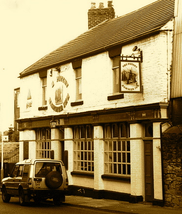
Patent Hammer Late 1990s
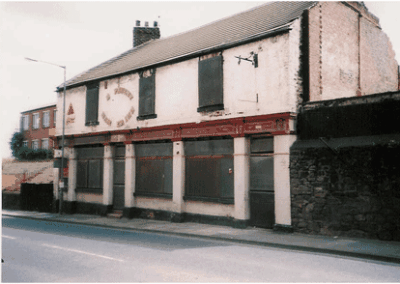
Patent Hammer ahead of demolition in
as well as the Saltmeadows House, Spires Deptford and the New Gateshead Inn. A haunt of the shipyard workers, forgive the pun as it is allegedly haunted, was the ’Ship Inn’ but now called the Schooner
Saltmeadows contained the Park Works, making anchors, chain cables, brass, copper and tin products as well as Hawks, Crawshay & Sons who famously made and erected The High Level Bridge to the design by Gateshead's Robert Stephenson
Full story by Michael Faulkner
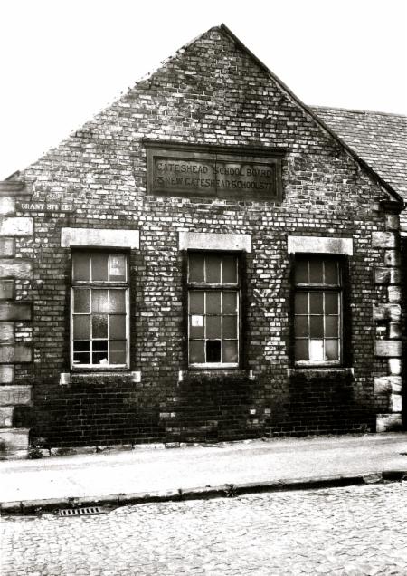
Grant Street School, Grant Street/Hawks Street, 1971
Photographer: Manders, Frank
Date: 30/06/1971
Reference Number: GL009217
New Gateshead School
For the best overview of Saltmeadows
go to gatesheadlocalstudies
and type saltmeadows into search bar..45 results
south shore brings 42 results
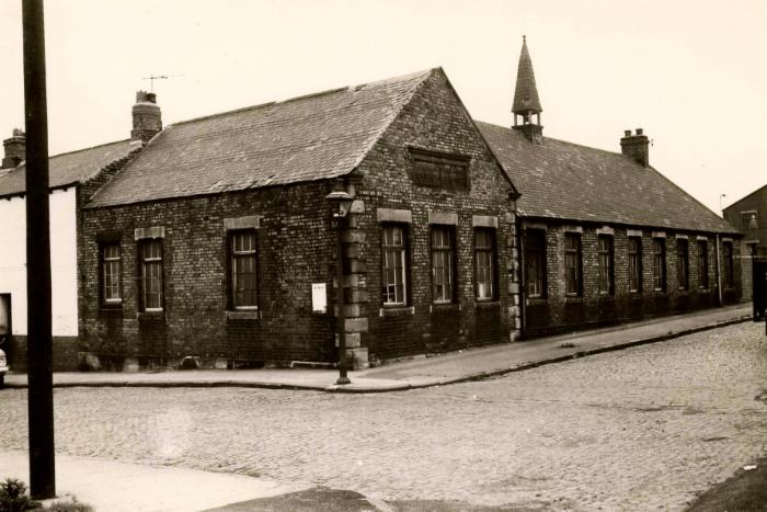
Grant Street School, Gateshead, 1971
New Gateshead School
Photographer: Manders, Frank
Date: 30/6/1971
Reference Number: GL001420
The white building next door is the New Gateshead Inn which closed in 1981
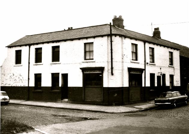
New Gateshead Inn, Hawks Street, 1971
Photographer: Manders, Frank
Date: 30/6/1971
Reference Number: GL001387
Have a Haven Holiday
Click the Link

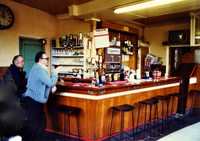
New Gateshead Inn (Interior) Hawks Street, Gateshead
Photographer: Unknown
Date: Unknown
Reference Number: GL004433
Photographer: Unknown
Date: 1997
Reference Number: LS000351
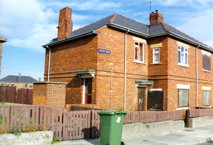
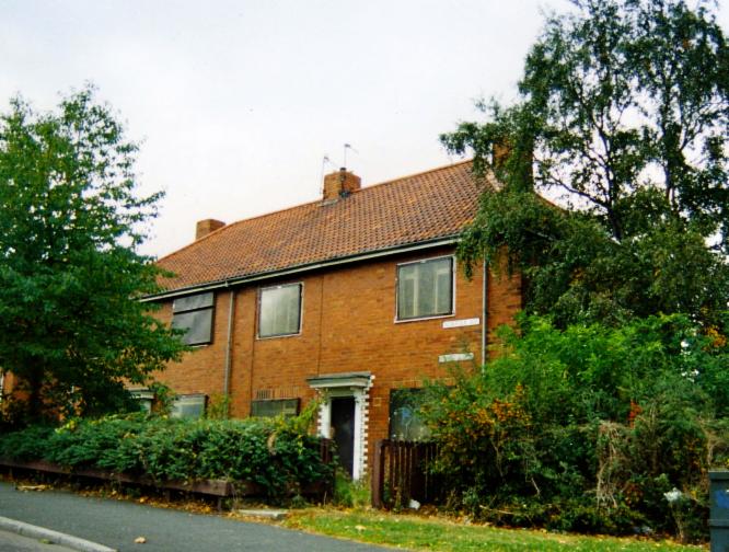
Photograph of flats on Albany Road.
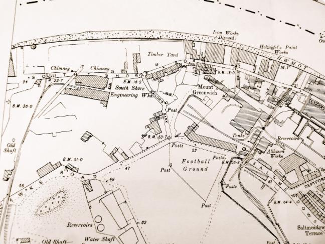
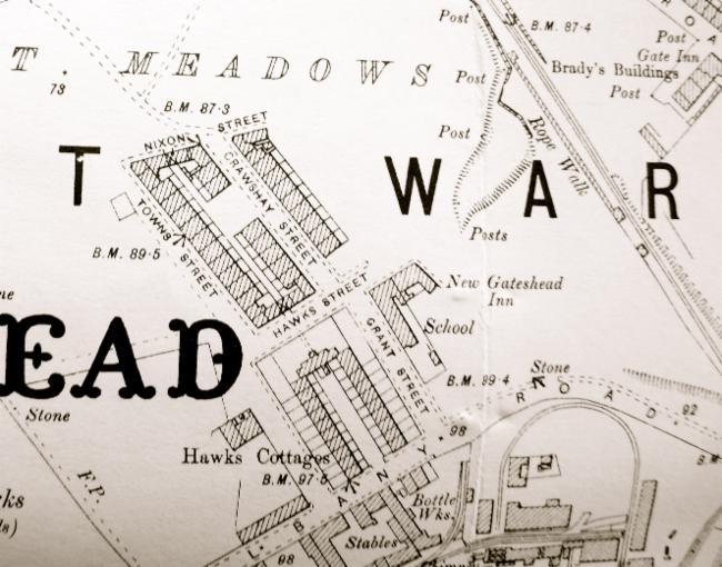
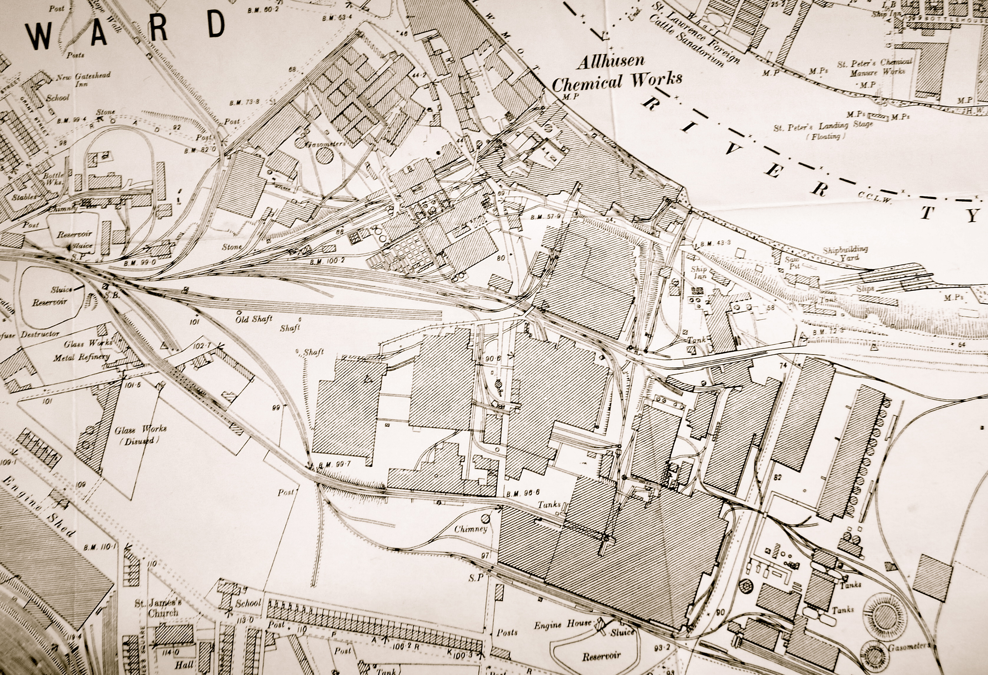
1895 Map showing Salt Meadows between the river/South Shore Road and Hawks Road/Saltmeadows Road with
Nailor's Bank running between. There's South Shore Engineering Works and on the rivers edge there's the Disused Iron Works
next to Holzapfel's Paint Works
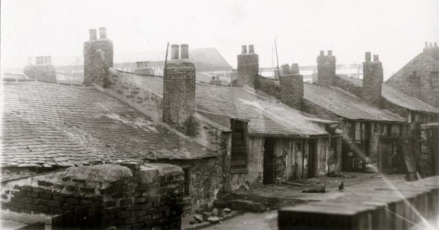
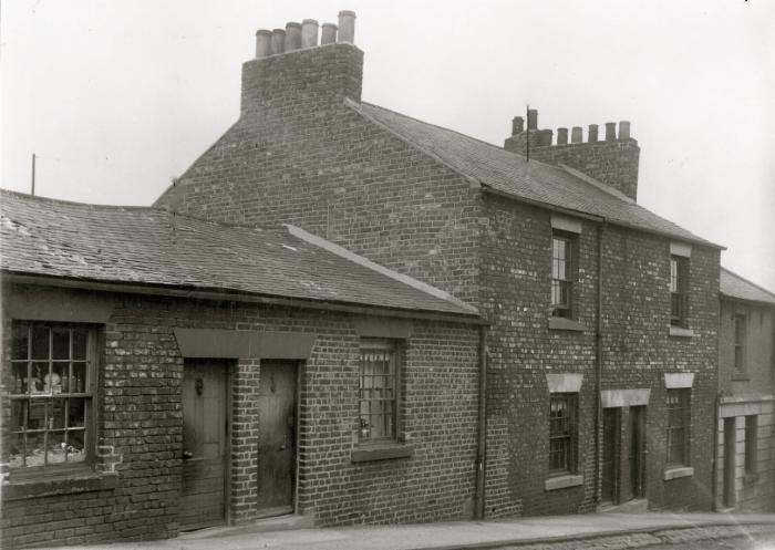
Rear of 14-28 Quarryfield Road, Gateshead, 1938
Photographer: Unknown
Date: 1938
View of Quarryfield Road Ref: GL005158
Quarryfield
Road was located near to the iron works and housed people living on or
below the poverty line in two and single storey terraced homes.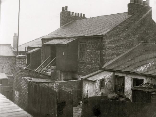
Rear of 8-14 Quarryfield Road, Gateshead, 1938
Photographer: Unknown
Date: 1938
Reference Number: GL005159
Have a Haven Holiday
Click the Link
8-38 and 7-41 Quarryfield Road, Gateshead, 1938
Photographer: Unknown
Date: 1938
Reference Number: GL002858
8-38 and 7-41 Quarryfield Road, Gateshead, 1938
Photographer: Unknown
Date: 1938
Reference Number: GL00516
More
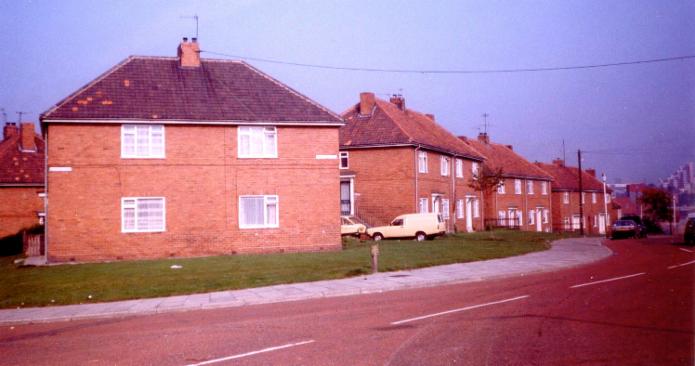
semi-detached homes emerged on the site of the former South Shore Brick
works during the inter-war years at Norfolk, Suffolk and Dorset Road.
Norfolk Road, Gateshead, 1985
Photographer: Elrington, W.P
Date: September 1985
Reference Number: GL004553
Norfolk Road, Saltmeadows 1997
Photographer: Unknown
Date: 1997
Reference Number: LS000352
Photograph of derelict houses on Norfolk Road.
Coulthard's Lane, Saltmeadows 1997
Photographer: Unknown
Date: 1997
Reference Number: LS000349
Houses on Coulthard's Lane looking west towards the junction with Quarryfield Road.
Derelict houses at the corner of Coulthards Lane and Thirwell Road 1997
Photographer: Unknown
Date: October/November 1997
Reference Number: LS000304
Photographer: Unknown
Date: 1997
Reference Number: LS000348
Saltmeadows Community Centre, Nixon Street 1997
Photographer: Unknown
Date: 1997
Reference Number: LS000350
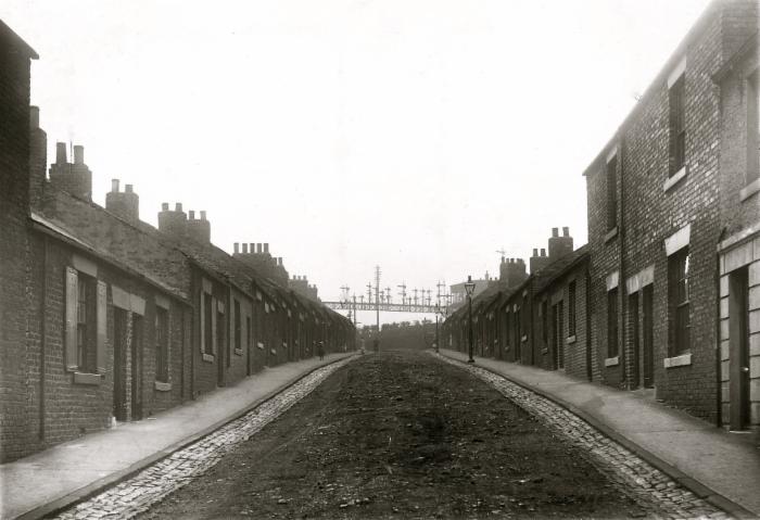
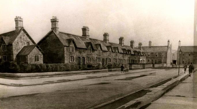 Hawks Cottages, Albany Road, Saltmeadows, c1920
Photographer: Unknown
Date: C1920
Saltmeadows House Photographs Ref: GL002360
Hawks Cottages were constructed by John &
Benjamin Greene for the workers employed at Hawks Iron works c 1860.
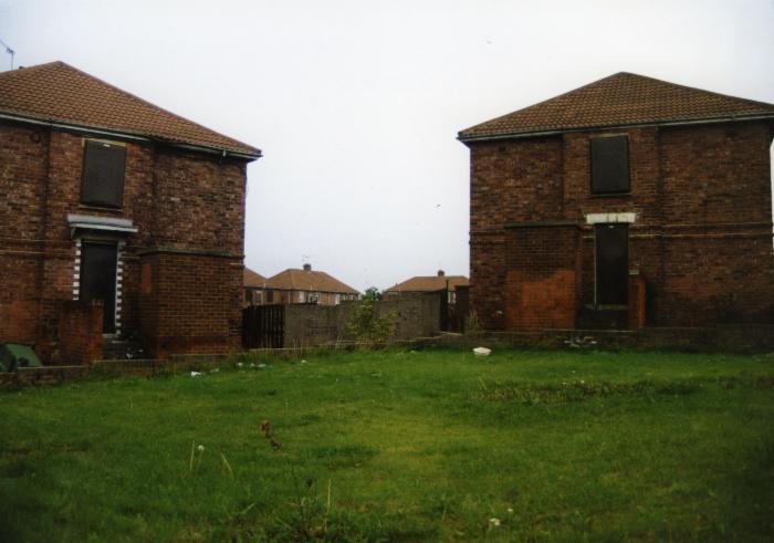
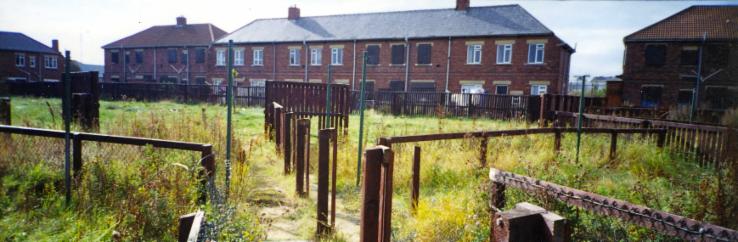
They were demolished in the 1960's. That's when New Gateshead became old Gateshead, then gone Gateshead
Gone Gateshead
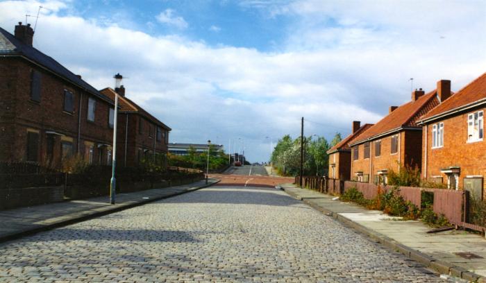
Those streets now
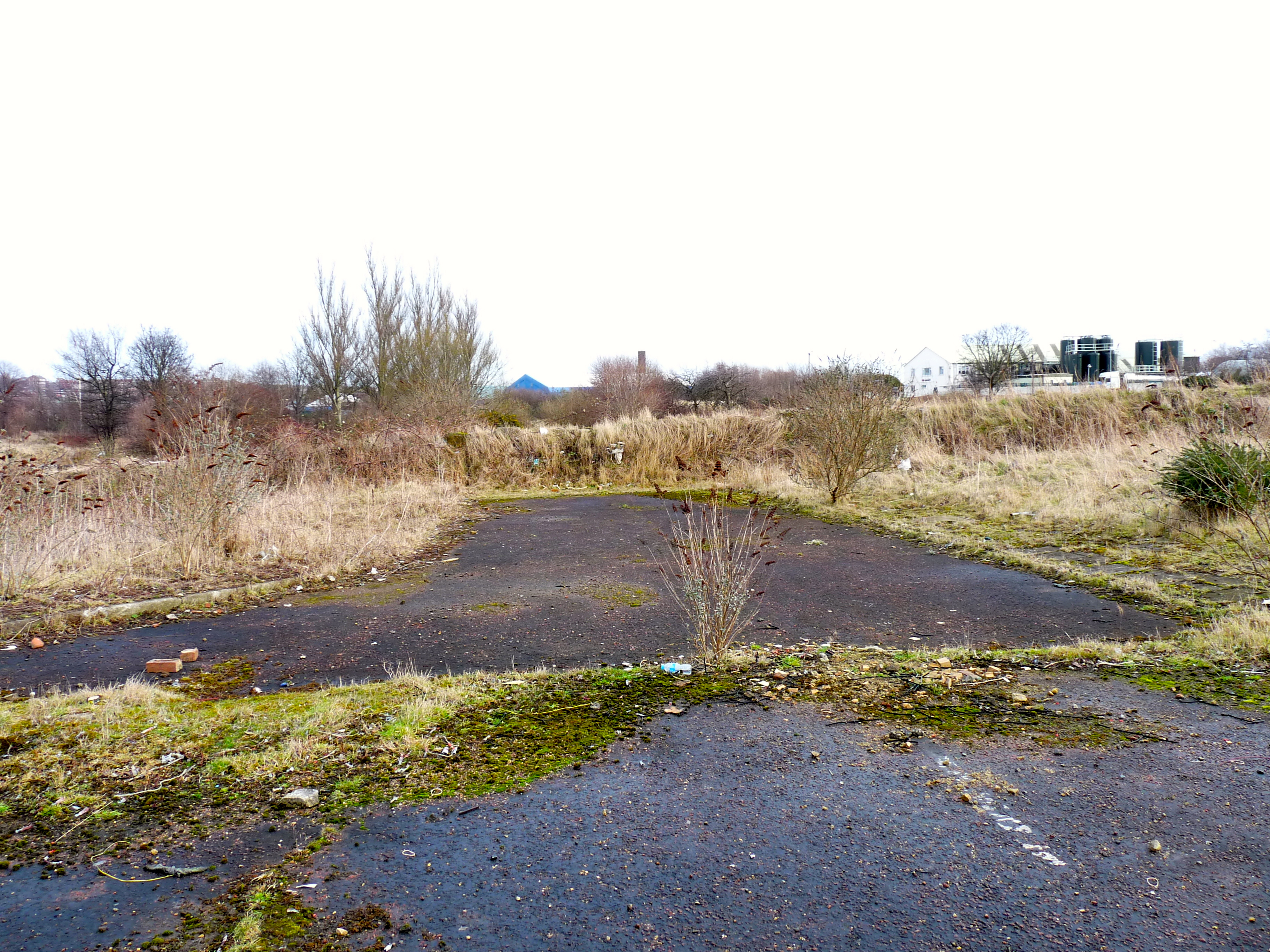
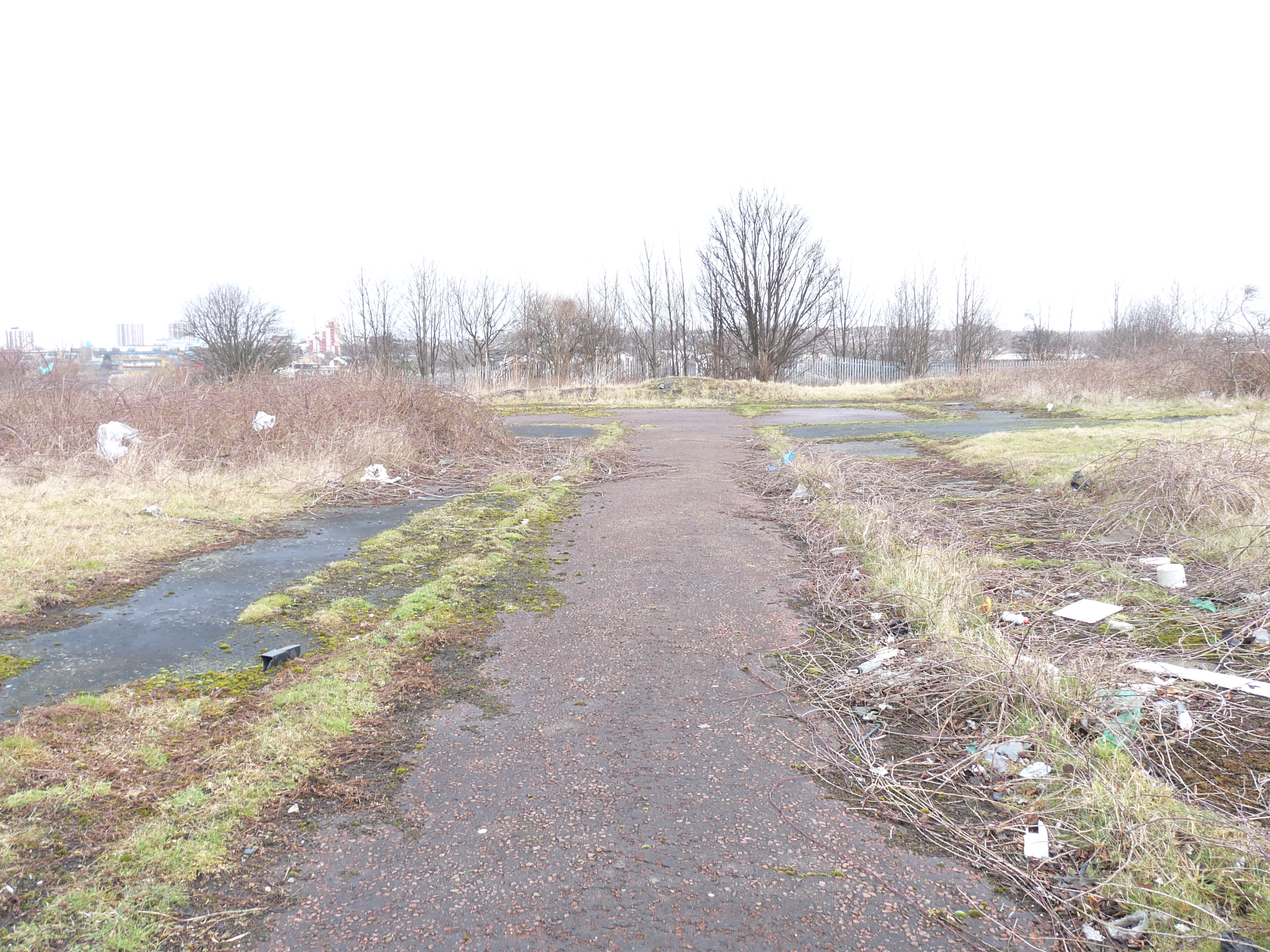
Covered a large area. See the top left hand corner of the map showing the school, pub and houses...not far to "waalk to wauk"
Photographer: Unknown
Date: C1910
Reference Number: GL001313
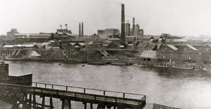
The river frontage at South Shore was one of the main locations for the chemical industry. By the nineteenth century,
it was already a conglomeration of industries; glass, soap and iron. In the early nineteenth century, various chemical works
opened. In 1828, Thomas Doubleday and Anthony Easterby, Newcastle manufactuerers, sought to change the use of
some land at Gateshead from whale oil to oil of vitriol manufacture. The high price of alkali led them to use recovered
soapers salts. The first sulphuric acid chambers on the Tyne had been set up for this purpose in 1809 at Bill Quay
(Cambell, 1968, p17). A 'Sulphuric Works' on Pipewellgate is marked on the first edition County Series Ordnance Survey
Map of 1857.
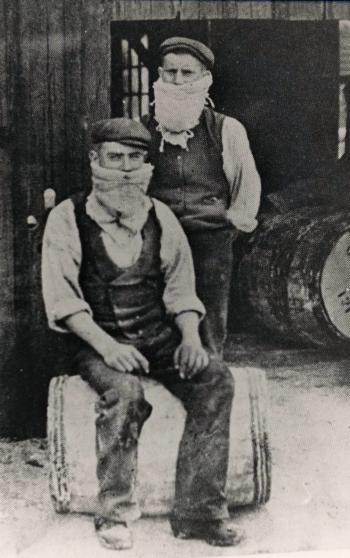
Bleach Packers, Alhusen's Chemical Works, Gateshead
Photographer: Unknown
Date: Date Unknown
Reference Number: GL001319
Saltmeadows Old Photographs of
Quarryfield Road, Albany Road, Hawks Road, Saltmeadows Road, St Lawrence Road, Thirwell Road, Nixon Street, South Shore Road
brought to you by

The Felling Heritage Group
and
Gateshead Council